Map - Tolna County (Tolna megye)

Tolna County (Tolna megye)
Tolna (Tolna vármegye, ; Komitat Tolnau) is an administrative county (comitatus or vármegye) in present Hungary as it was of the former Kingdom of Hungary. It lies in central Hungary, on the west bank of the river Danube. It shares borders with the Hungarian counties Somogy, Fejér, Bács-Kiskun, and Baranya. The capital of Tolna county is Szekszárd. Its area is 3703 km2.

Tolna (in Latin: comitatus Tolnensis) was also the name of a historic administrative county (comitatus) of the Kingdom of Hungary. Its territory, which was about the same as that of present Tolna county, is now in central Hungary. The capital of the county was Szekszárd.

 
Map - Tolna County (Tolna megye)
Map
Google Earth - Map - Tolna County
Google Earth
Openstreetmap - Map - Tolna County
Openstreetmap
Map - Tolna County - Esri.WorldImagery
Esri.WorldImagery
Map - Tolna County - Esri.WorldStreetMap
Esri.WorldStreetMap
Map - Tolna County - OpenStreetMap.Mapnik
OpenStreetMap.Mapnik
Map - Tolna County - OpenStreetMap.HOT
OpenStreetMap.HOT
Map - Tolna County - OpenTopoMap
OpenTopoMap
Map - Tolna County - CartoDB.Positron
CartoDB.Positron
Map - Tolna County - CartoDB.Voyager
CartoDB.Voyager
Map - Tolna County - OpenMapSurfer.Roads
OpenMapSurfer.Roads
Map - Tolna County - Esri.WorldTopoMap
Esri.WorldTopoMap
Map - Tolna County - Stamen.TonerLite
Stamen.TonerLite
Country - Hungary
Flag of Hungary
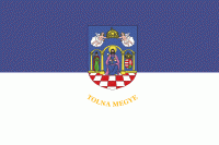
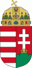
Hungary (Magyarország ) is a landlocked country in Central Europe. Spanning 93030 km2 of the Carpathian Basin, it is bordered by Slovakia to the north, Ukraine to the northeast, Romania to the east and southeast, Serbia to the south, Croatia and Slovenia to the southwest, and Austria to the west. Hungary has a population of 9.7 million, mostly ethnic Hungarians and a significant Romani minority. Hungarian, the official language, is the world's most widely spoken Uralic language and among the few non-Indo-European languages widely spoken in Europe. Budapest is the country's capital and largest city; other major urban areas include Debrecen, Szeged, Miskolc, Pécs, and Győr.

The territory of present-day Hungary has for centuries been a crossroads for various peoples, including Celts, Romans, Germanic tribes, Huns, West Slavs and the Avars. The foundation of the Hungarian state was established in the late 9th century AD with the conquest of the Carpathian Basin by Hungarian grand prince Árpád. His great-grandson Stephen I ascended the throne in 1000, converting his realm to a Christian kingdom. By the 12th century, Hungary became a regional power, reaching its cultural and political height in the 15th century. Following the Battle of Mohács in 1526, it was partially occupied by the Ottoman Empire (1541–1699). Hungary came under Habsburg rule at the turn of the 18th century, later joining with the Austrian Empire to form Austria-Hungary, a major power into the early 20th century.
Currency / Language  
ISO Currency Symbol Significant figures
HUF Hungarian forint Ft 2
ISO Language
HU Hungarian language
Neighbourhood - Country  
  •  Austria 
  •  Croatia 
  •  Romania 
  •  Serbia 
  •  Slovakia 
  •  Slovenia 
  •  Ukraine